Features QH sử dụng đất Sóc Trăng
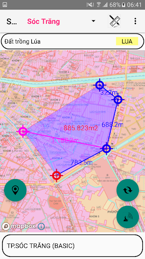
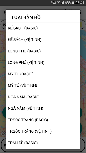
- Support to look up land use planning, land use plan in Soc Trang province- Cu Lao Dung, Ke Sach, Nga Nam, Long Phu, My Tu, HCMC Soc Trang, Tran De, Vinh Chau- Use Mapbox.com basemap technology on published land use plans- Determine users current location on land use planning map- Using 02 coordinate systems of Longitude, Latitude and coordinate system VN2000- Support map zoom function, rotate Map along North-South axis- Find and mark current location by name- Electronic compass (supports only devices with magnetic sensors)- Support to customize the transfer calculation parameters- Save and Display points, areas, areas by Objects, Projects- Change colors, hide objects, points in the Project- Save the free drawn area- View, Edit, Delete, Find Landmarks- Function of navigation to objects, save points- Support to re-draw the survey route from time to time- Support function of displaying map styles from mapbox.com- Draw Points, Polygonal Domains; Measure Distance, Calculate Area- Export point data to .kml .gpx files- Support importing point data from .gpx file- Send and exchange data of saved points- Supports converting tools between coordinate systems
Gaming Features
Enjoy immersive gaming experience with various game modes.
Lifestyle
Enhance your lifestyle with personalized tips and features.
Smart Home
Control and monitor your home with smart features.
See the QH sử dụng đất Sóc Trăng in Action
Get the App Today
Available for Android 8.0 and above